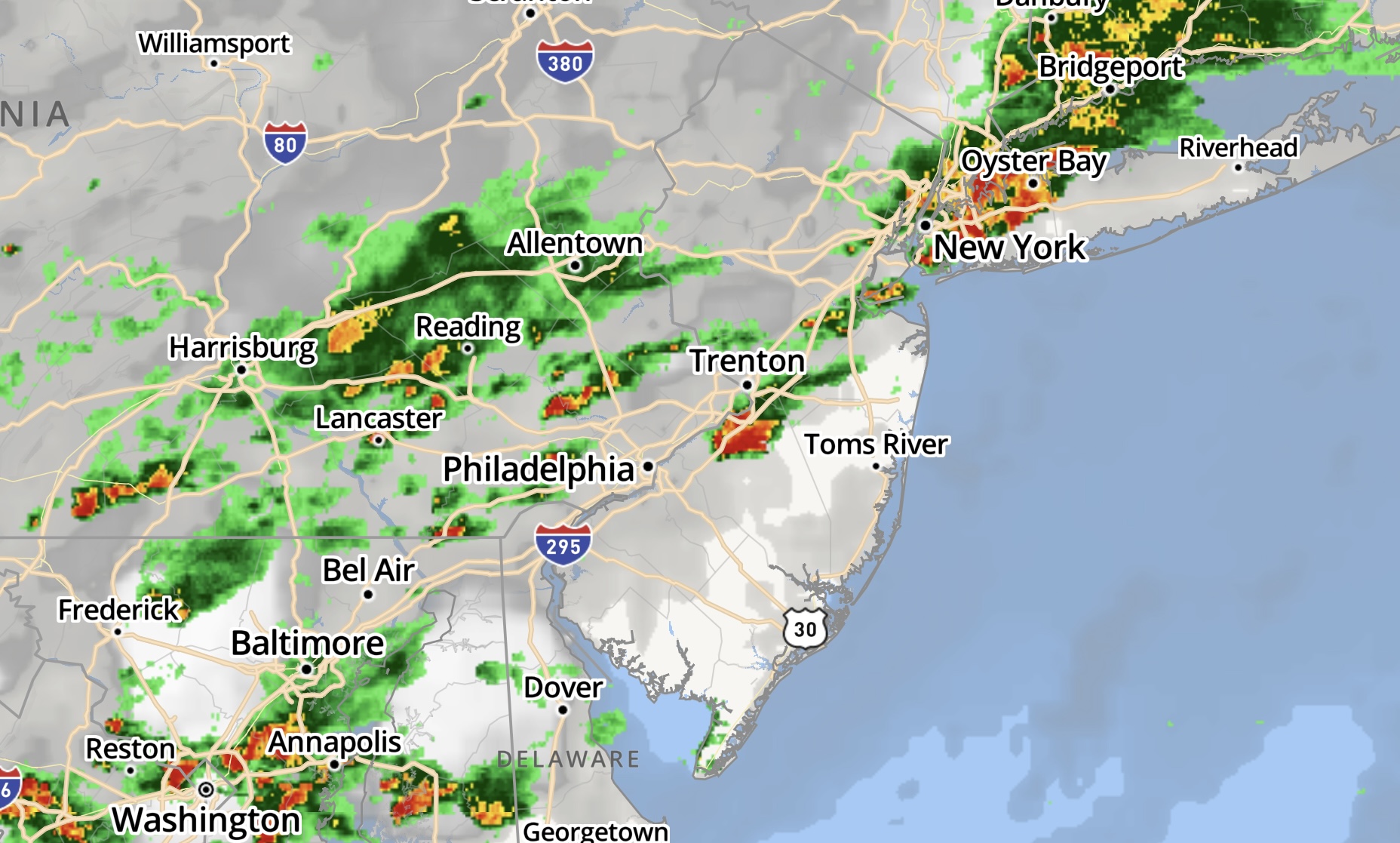
The weather radar at 4:55 p.m., June 2, 2022. (Credit: NWS)
The National Weather Service has issued a severe thunderstorm watch for Ocean County until 9 p.m. Thursday, the agency said.
Showers and thunderstorms are forecast for the evening hours Thursday, moving west-to-east and affecting the coast latest. Some storms could be severe, with damaging winds and heavy rain, the NWS said. The temperature will be steady around 68 degrees, with southeast wind around 10 m.p.h.
A severe thunderstorm watch has been issued for parts of DE, DC, MD, NJ, PA, VA, WV until 9 PM EDT pic.twitter.com/i6HRoiiMmS
— NWS Mount Holly (@NWS_MountHolly) June 2, 2022

Lavallette bayfront, June 2, 2022. (Photo: Daniel Nee)
Showers and thunderstorms will be a continued through before midnight, then showers likely and possibly a thunderstorm between midnight and 1 a.m., followed by scattered showers and thunderstorms for the remainder of the overnight hours. Some storms could be severe, with damaging winds and heavy rain. Patchy fog is forecast after 1 a.m. with a low around 65 degrees.
Isolated showers will remain in place Friday before 11 a.m. and fog will continue all morning. Eventually, the sun is forecast to break through with a high of 71 degrees.


Police, Fire & Courts
Thief Robs Toms River Restaurant, Pictured Walking Down Street Carrying Safe


Police, Fire & Courts
Intricate Nature of Toms River Jewelry Heist Revealed; TRPD Has Leads
Police, Fire & Courts
Thief Robs Toms River Restaurant, Pictured Walking Down Street Carrying Safe


